Subject: Colonial Mid-Atlantic
Period: 1676 (circa)
Publication: The Theatre of the Empire of Great Britain…
Color: Hand Color
Size:
19.5 x 15 inches
49.5 x 38.1 cm
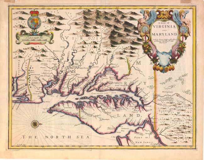
The English text verso gives an up-to-date description of the colonies, adding to the appeal of this sought-after and decorative map engraved by Francis Lamb. Oriented with north to the right, the map shows both the Chesapeake and Delaware Bays and Part of New Iarsy. Following John Smith's general outline, Lamb draws upon Augustine Herrman's landmark map for improved geography and English nomenclature, as well as its depiction of the Delaware Bay and River. The boundary between Virginia and Maryland on the eastern shore, settled in 1688, is depicted with the Herrman-like usage of a double line of trees. The map is beautifully decorated with the Royal Arms of England and a large elegant title cartouche. First state with the imprint of Bassett and Chiswell.
References: Burden #456; Goss (NA) #40 Tooley (Amer) p.170, Derivative 9, state 1.
Condition: B+
Sharp impression with good margins. There is an old repaired tear that enters the border at top near center and an unrepaired tear in the top margin, not affecting the map. Small masking tape hinges on verso of top margin have left stains. Old owner's label attached on verso in margin.