Subject: United States - New England
Period: 1827 (circa)
Publication:
Color: Hand Color
Size:
22 x 17 inches
55.9 x 43.2 cm
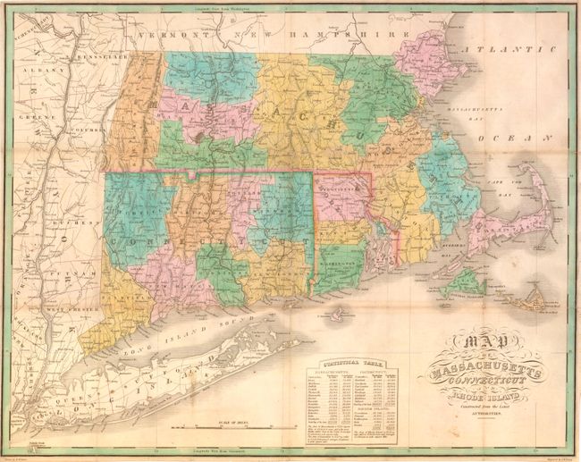
This folding version of Finley's atlas map delineates the counties, roads, limited watershed, scores of towns and villages. The "Statistical Table" gives populations by county for 1810 and 1820. Maps from Finley's folio A New American Atlas are scarce, but the 15 maps were also published in a rare pocket atlas version that is scarcer still. The maps in this issue were printed on thin paper folding into 3.5" x 6" format. This example is from an edition published between 1827 and 1830. Ristow says, "The same plates, with dates and publisher's name changed, were used by S. Augustus Mitchell in 1831 for an atlas published under the same title as Finley's 1826 volume." This map does not contain Mitchell's imprint and appears as an unrecorded edition published by Finely prior to his collaboration with Mitchell.
References: cf Philips (A) #1378; Ristow page 270.
Condition: B+
Beautiful original hand coloring and strong impression with some toning most evident on major folds. Issued folding, now backed with archival tissue to support folds and fold intersections, a few with small loss.