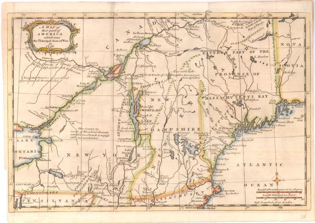
Subject: Colonial New England
Period: 1757 (published)
Publication: Gentlemen's Magazine
Color: Hand Color
Size:
13.3 x 8.8 inches
33.8 x 22.4 cm
This map covers the northeastern part of the present-day United States. It shows the areas that were the Principal Seat of the French & Indian War. A great deal of the conflict was focused around the upper Hudson and Lake Champlain, and the Mohawk River to Lake Ontario. Includes good detail with several forts involved in the war located, including William Henry, Frontenac, Edward, and Frederick. All these details and topographical information were important to the contemporary reader following the war from across the Atlantic. In Lake Champlain the Is. Of ye 4 Winds are located. Decorated with a nice title cartouche and small compass rose. Two distance scales.
References: Jolly GENT-102; Sellers & van Ee #78; McCorkle 757.4.
Condition: B+
Light, uneven toning otherwise very good. Binding trim in left margin.