Subject: Canada
Period: 1814 (dated)
Publication:
Color: Hand Color
Size:
15 x 13 inches
38.1 x 33 cm
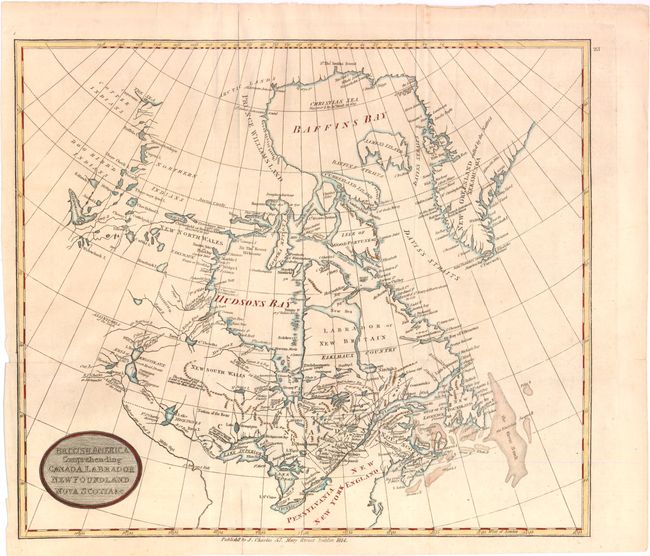
Scarce Irish-produced map of Canada that extends from Greenland across the continent to Great Slave Lake (here called Arathapescow Lake) north of today's Alberta. Delineates the lands of the Copper, Dog Ribb'd, and Northern Indians. Shows a small portion of coastline far to the north on the Beaufort Sea at the delta of the Copper River. Good detail of the river and lake systems from Great Slave to the Great Lakes and the St. Laurence River. The Mississippi River's source lies just south of Lake Winnipeg. Locates the Great Bank and numerous smaller fishing banks. Extends to name Pennsylvania, New York and New England. Publishers' imprint "J. Charles, 57 Mary Street Dublin 1814."
References:
Condition: B+
Dark early impression, printed on watermarked paper, "W. Pickering & Co. 1814." Issued folding, now pressed. One fold split enters map 1" at bottom, well closed on verso with paper.