Subject: World & Continents
Period: 1577-1608 (circa)
Publication:
Color: Hand Color
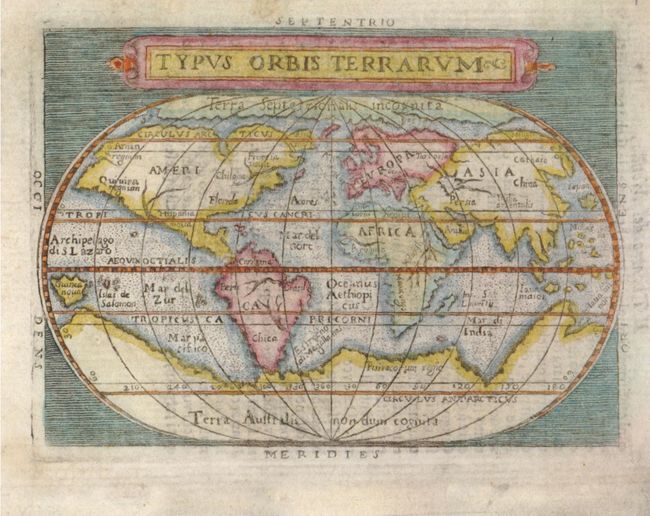
1) Typus Orbis Terrarum, published by Pietro Marchetti, from Il Theatro del Mondo, circa 1608 (4.1 X 3.1"). This map is based on Ortelius' famous oval map of the world. Huge polar continents provide balance for the world's continents and a Northwest Passage is prominently featured. Italian text on verso. Ref: Shirley #214.
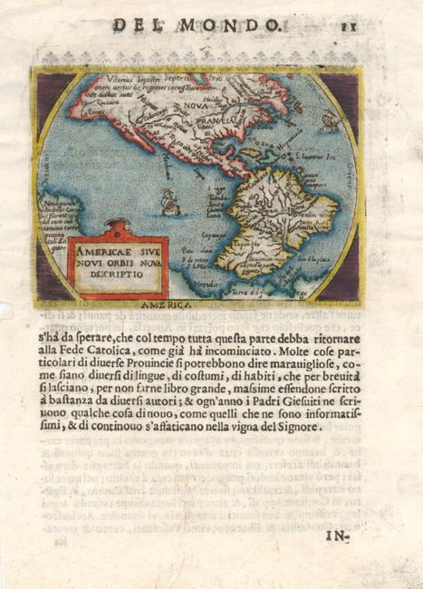
2) Americae Sive Novi Orbis Nova Descriptio, published by Pietro Marchetti, from Il Theatro del Mondo, published 1598 (4.2 X 3"). This map is a reduced version of the folio version of the Ortelius atlas of 1577. The bulge in the southwestern coastline of South America is present - even though it had already been corrected in the folio version of this period. In North America, several mythical place names appear, including Norembega, Quivira, Tolonteac, Tigues, and Cevola (the 7 golden cities). The map also features ships. Italian text below map and on verso. Ref: Burden #126. Condition: Minute tears in left-hand margin.
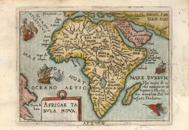
3) Africae Tabula Nova, published by Pietro Marchetti, from Il Theatro del Mondo, circa 1608 (4 X 3"). This miniature version of Ortelius' map of Africa features prominent lakes, rivers and cities, as well as ships and a sea monster. Italian text on verso. Ref: Betz #39. Condition: Minor soiling on edges.
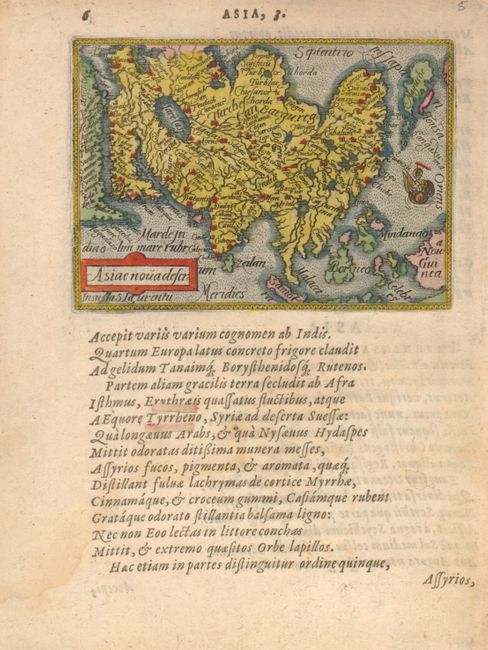
4) Asiae nova Descr, published by Phillip Galle, circa 1577-1598 (4.3 X 3"). This map is a reduced version of Ortelius' important map of Asia with its distinctive 'kite-shaped' Japan. Latin text below map and on verso. Ref: King (1st Edition) p. 52. Condition: Slight damp stain and paper repairs in text.
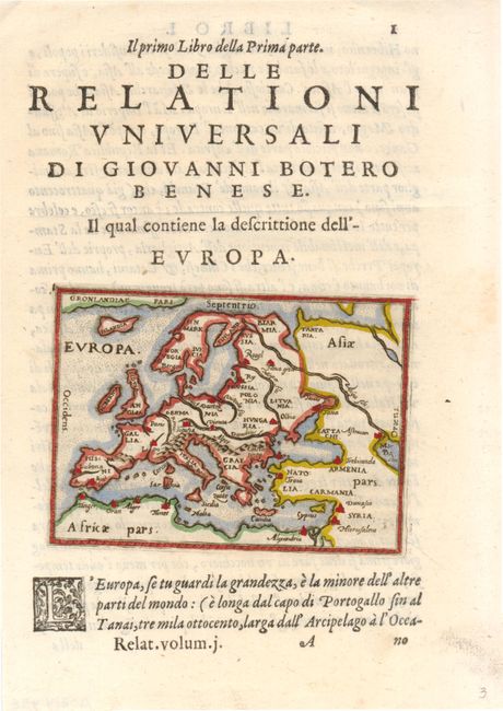
5) Europa, published by Pietro Marchetti, from Relationi universali di Giovanni Botero, published 1599 (4.1 X 2.8"). This miniature Ortelius map appears on the title page of the first volume, and shows minimal detail, stressing the major rivers and mountain ranges. Latin text above and below the map, as well as on verso. Ref: King (1st Edition) p. 66.
References:
Condition: A
See description.