Catalog Archive
Auction 136, Lot 105

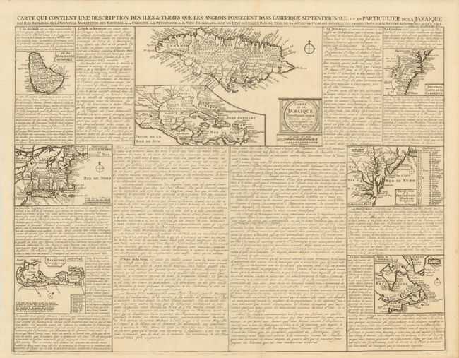
"Carte qui Contient une Description des Iles & Terres que les Anglois Possedent dans l'Amerique Septentrionale, et en Particulier de la Jamaique, des Iles Barbades, de la Nouvelle Angleterre, des Barmudes, de la Caroline, de la Pensilvanie …", Chatelain, Henry Abraham

Subject: Colonial North America, Caribbean & Bermuda

Period: 1719 (circa)

Publication: Atlas Historique…

Color: Black & White

Size:
20.5 x 16 inches
52.1 x 40.6 cm
Download High Resolution Image
(or just click on image to launch the Zoom viewer)

A very interesting folio sheet containing seven maps inset into panels of French text. The largest map (9 x 5.7") titled, "Carte de la Jamaique Nouvelle..." shows the island in great detail and includes a large inset of the Gulf of Mexico and West Indies. The other maps illustrate Barbados, Bermuda and the British colonies in North America (in four regional maps). Together these maps cover all of the regions colonized by the English at the early part of the 18th century.

References: McCorkle #719.3.

Condition: A

There is an old paper repair on a short fold separation at bottom and hinge remnants on verso.

Estimate: $350 - $425

Sold for: $250

Closed on 6/1/2011

Archived