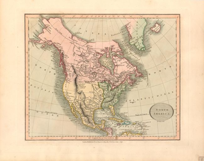
Subject: North America
Period: 1816 (dated)
Publication: New Universal Atlas
Color: Hand Color
Size:
11 x 9 inches
27.9 x 22.9 cm
This handsome, small map of the continent contains a great amount of detail. The United States is shown with its boundary on the Mississippi River, with Louisiana Territory named and separately colored but no suggestion that it is part of the United States as ceded in 1803. The geography in the Pacific Northwest is pre-Lewis and Clark, this being one of the last maps issued prior to the release of their journal and map the following year. The west coast is New Albion and the interior is completely blank. The Rocky (Stony) Mountains are a mostly straight spine of mountains to about the area of Colorado where they split in two directions. The interior of Alaska and the Yukon are completely blank and the Alaska Peninsula is labeled "Aliaska." Along the Pacific coast between Washington and Alaska are the uncommon regions of New Georgia, New Hanover, New Cornwall, and New Norfolk. Oval title cartouche with fully ruled lines in the background. Below the neatline is the imprint "Published by J. Cary Engraver & Mapseller No. 181 Strand June 1st 1816".
References: Gross (NA) #72.
Condition: A+
Beautiful original hand coloring, very early and crisp impression on thick paper with wide margins.