Subject: Western Hemisphere
Period: 1800 (dated)
Publication:
Color: Hand Color
Size:
24 x 18.5 inches
61 x 47 cm
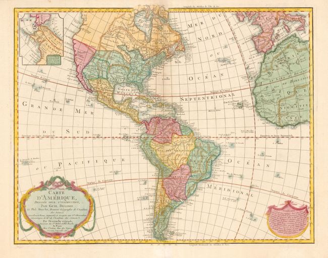
Dezauche, the successor to the Delisle cartographic firm, issued this edition of the famous Delisle map of the Americas first published in 1722. The map has been extensively updated through numerous revisions. This one includes the information from Cook's discoveries in the Northwest and Alaska in an inset "Supplement a la Partie Nord Ouest de l'Amerique d'apres les Decouvertes du Capitaine Cook." The newly independent United States extends to the Mississippi River in the west and to Florida in the south. A garland style title cartouche and another cartouche containing an advertisement decorate the lower corners. In this edition the Privilege is changed from "du Roi" to "l'Auteur Rue des Noyers Garantie Nationale An. 9." Due to the French Revolution the Royal arms were erased from the cartouche and replaced by ribbons, the king's name was removed from the title, and the date (An 9) refers to the French Republican calendar for 1800.
References: Tooley (Amer) p.16, #17.
Condition: A+
Beautiful example on thick paper with wide margins. Strong, early impression. A hint of toning in the Atlantic off the eastern seaboard, still fine.