Subject: Western Hemisphere
Period: 1791 (dated)
Publication:
Color: Hand Color
Size:
29 x 20.5 inches
73.7 x 52.1 cm
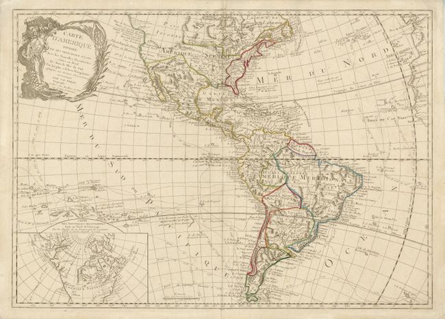
The era of exploration is dramatically shown on this rare map with the tracts of explorers shown, including Magellan, Mendana, Quiros, Le Maire, Bougainville, Furneaux and Cook. It was first issued by Jean Baptiste Louis Clouet in 1787 with a slightly different title (Carte d'Amerique divisee en ses principaux Pays Dressee sur les Memoires les plus recents, et sur Differents Voyages). In this edition the plate has been revised to eliminate the erroneous Sea of the West and update the inset to reveal the discoveries of Captain Cook in the Pacific Northwest and Alaska. In North America, the young United States is shown to include Florida and Nova Scotia with a huge Louisiana Territory beyond. In South America a large Paraguay takes in Buenos Aires. The decorative title cartouche features a female personification of America riding a fierce alligator. Both states of the map are extremely rare.
References:
Condition: A
Original outline color with slight surface soil.