Subject: Western Hemisphere
Period: 1790 (circa)
Publication:
Color: Hand Color
Size:
22.6 x 17.7 inches
57.4 x 45 cm
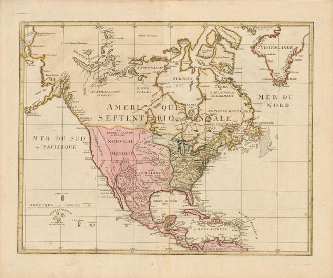
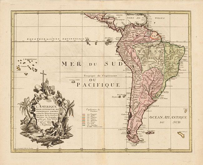
A very uncommon map of the Americas on two separate sheets, made in Germany for the French market and sold by Martin Will. In North America, the young United States incorporates the upper Midwest with its boundary along the Mississippi River. Spain controls the remaining western territories of Louisiana, Nouveau Mexique, Nouveau Albion and Californie in addition to its possessions in Florida. The explorations of Captain Cook are evident in Alaska, which appears in a very unusual tadpole shape. Spain controls vast regions of South America with smaller regions shown to be the possessions of Portugal (Brazil) and France (Guyana). The Dutch colony of Demerara is incorrectly colored as a possession of Sweden. The elaborate cartouche refers to the conversion of Native Americans to Christianity, with natives bowing to a figure holding a cross and chalice while an Amazon queen reclines in the foreground surrounded by an alligator, a parrot and a monkey.
References:
Condition: B+
Overall very good with just a hint of toning along the centerfolds.