Subject: Western Hemisphere
Period: 1763 (dated)
Publication:
Color: Hand Color
Size:
24.2 x 19.2 inches
61.5 x 48.8 cm
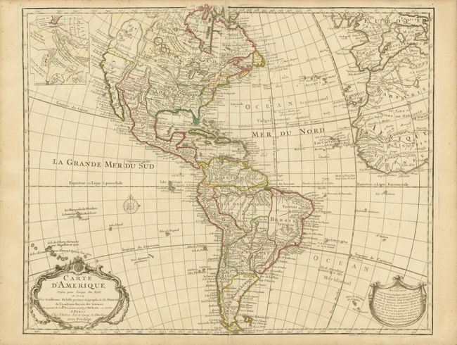
Guillaume Delisle's map of the Americas [1722] was one of the most popular maps of the 18th century with numerous editions published. This is the important seventh state of the map, notable because of its depiction of the mythical Sea of the West and the depiction of Philip Buache's remarkable theories concerning a Northwest Passage. The huge inland sea dominates the Pacific Northwest and a large inset illustrates Buache's elaborate theories including a conjectural Lac de Valasco. In Labrador another hypothetical inland sea (Mer Nouvellement Decouverte) makes an appearance. In South America, Brazil is separated from the Pays des Amazones.
References: Tooley (America) #7, p. 14.
Condition: A
Original outline color with a bit of light foxing in the blank margins.