Subject: Southern Africa - Explorations
Period: 1858 (dated)
Publication:
Color: Hand Color
Size:
16.8 x 20.8 inches
42.7 x 52.8 cm
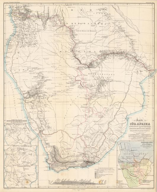
This very detailed map features the explorations of Dr. Livingstone with his probable routes (1841 - 1856) shown in red and extending from Cape Town through the interior and out to both coasts. The explorations of Gamitto (1831), Moffat (1854), Galton (1850-1851), and Anderson (1851-1853) are also delineated. The map is very finely engraved to show extensive watershed and topography with many villages named. Large inset at lower right uses color and line to identify the location of the Hottentots; Betschuana; Kifir; Neger-Stajmme; Gemischte; Betschuanen u. Kafir and other peoples. Three insets at left present the geography of central Africa per H. Kiepert, Nov. 1855; J. McQueen, March 1857; and D. Livingstone, Nov. 1857. At lower center is a geological profile of the continent with the legend identifying 10 formations using different patterns.
References:
Condition: A
Folding as issued. Fine impression and color with just two light spots near bottom.