Subject: Africa
Period: 1798 (dated)
Publication: Atlas National
Color: Hand Color
Size:
16.5 x 12.5 inches
41.9 x 31.8 cm
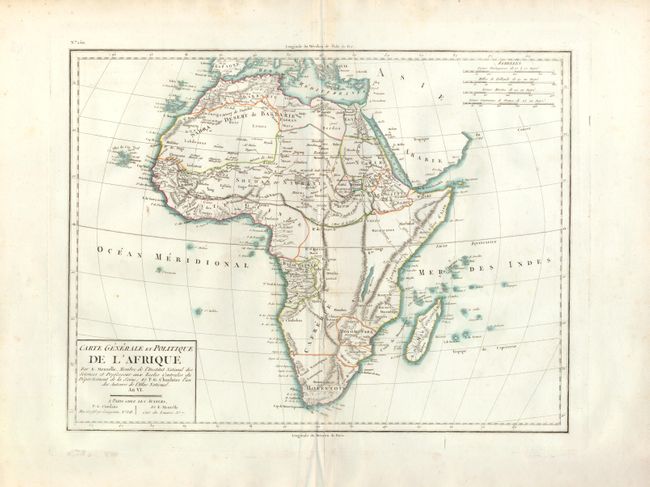
This handsome, large map of Africa was drawn by Edme Mentelle, a member of the Royal Institute of Science and Professor of the Central Schools Department of Seine. The cartography of the Nile River is fairly accurate, completely abandoning the earlier idea that the Nile River originated in two large lakes below the equator. The southern portion is occupied by the Hottentots and the Kingdom of Monomotapa is located. The source of the Niger River is named, but the river flows eastward to a land locked lake in the Desert de Seth. The south-central portion of the continent is mostly blank. Simple title cartouche contains 'An VI' indicating the publication date of 1798 as opposed to the date Norwich gives to the very similar map referenced, also by Mentelle. Four distance scales are in upper right corner.
References: cf Norwich #131.
Condition: B+
A nice example with fine impression and color on a full sheet with very wide margins and two watermarks. No flaws but a small area of soiling at center and some paper cockling along centerfold in lower half.