Subject: Africa
Period: 1722 (published)
Publication: Atlas Geographique et Universel
Color: Black & White
Size:
24.6 x 19.3 inches
62.5 x 49 cm
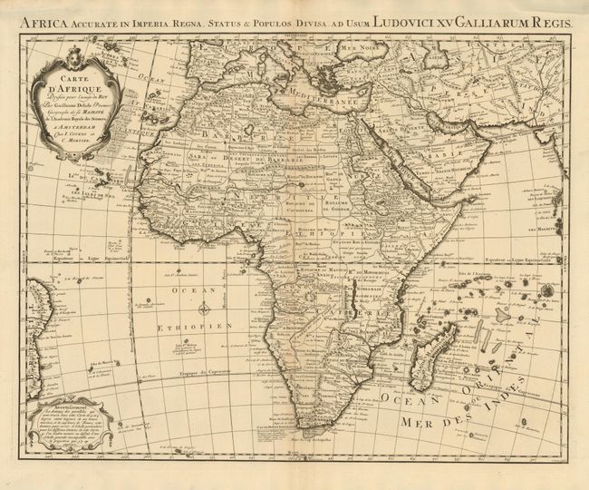
This is the Covens & Mortier edition of Delisle's second map of the continent (1722). Delisle's first map of 1700 was a landmark in the mapping of the continent; the first to show the Nile's source in Lake Tana, rather than on the Ptolemaic concept, and the first to correctly show the width of the northern shape of Africa. In this updated map, Lake Maravi (Malawi) in Central Africa appears for the first time, and the Senegal and Niger Rivers are correctly separated. The major kingdoms and tribes are shown. Two decorative cartouches grace the map, and the Latin dedication title appears in the top margin, Africa Accurate in Imperia, Regna, Status & Populos Divisa ad Usum Ludovici XN Galliarum Regis.
References: Betz p. 498; Norwich #78; Tooley #70.
Condition: A+
Spectacular, dark impression on a thick sheet of hand laid paper with wide margins.