Subject: Bali, Indonesia
Period: 1724 (circa)
Publication: Oud en Nieuw Oost-Indien
Color: Black & White
Size:
22 x 17.6 inches
55.9 x 44.7 cm
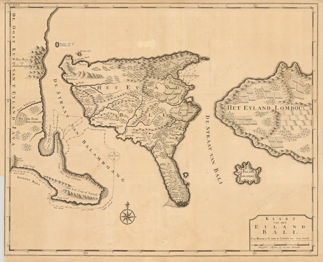
This is the first large map to focus on the Indonesian island of Bali. Based on the configuration of Lodewijcksz, it shows the mountainous island with numerous villages and cultivated fields on the eastern side with the adjacent coastlines of Java and Lombok. While the Dutch controlled much of the Indonesian archipelago during the seventeenth and eighteen centuries, Bali remained an independent kingdom that conducted trade with the Dutch in Jakarta. Valentyn was a prominent historian of the Dutch East India Company who is best known for Oud en Nieuw Oost Indien, his vast illustrated account of the Dutch trading empire in Asia. He twice traveled to the East Indies and served as Calvinist minister to Ambon between 1686 and 1694. In preparing this monumental work, he was given privileged access to the previously secret archives of the VOC, containing transcripts and copies of important earlier Dutch voyages. The map was drawn and engraved by Jan van Braam and Gerard onder de Linden.
References:
Condition: B+
Folded as issued. Binder's trim at lower left, nearly to neatline with a tiny tear just touching neatline. There are a couple small tears in the top margin, one that enters the border. There is some faint uneven toning.