Subject: Southeast Asia
Period: 1666 (circa)
Publication: Nieuwe Water-Werelt ofte Zee Atlas
Color: Black & White
Size:
21 x 16.8 inches
53.3 x 42.7 cm
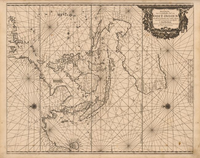
This fine, rare sea chart illustrates the Dutch sphere of influence in Southeast Asia and Australia. It encompasses the entire region from the Coromandel coast of India to the Mariana Islands, and from Japan to Australia. The map is oriented with east at the top by two compass roses and decorated with a fine title cartouche fashioned with a garland of kelp and sea shells. It is most notable in illustrating the Dutch discoveries in northern and western Australia including Able Tasman's 1644 voyage from Cape York to Western Cape. The map was first published by Johannes van Loon in 1661, and was reissued by Jacob and Caper Jacobsz in 1666, who took the name Lootsman (sea pilot) to avoid confusion with another Amsterdam publisher of the name Jacobsz.
References: cf Tooley (MCC-23) #31;
Condition: B+
Sharp impression with some minor surface soil, else very good.