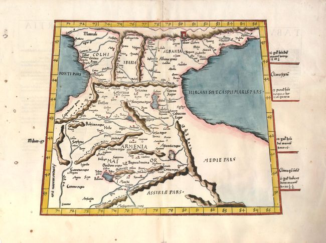
Subject: Caucasus
Period: 1541 (published)
Publication: Claudii Ptolemaei Alexandrini Geographicae…
Color: Hand Color
Size:
14.5 x 11.7 inches
36.8 x 29.7 cm
Fine Ptolemaic map of the region between the Black and Caspian Seas with Armenia, Choli, Iberia and Albania on the eastern frontier of the Roman Empire. The woodcut map from the blocks of Laurent Fries is based on the work of Waldseemuller. Geographically the map is classic Ptolemy, trapezoid in outline with convoluted mountain ranges. This edition is a reissue of the 1535 edition that was edited by Michael Villanovus (Servetus) but with the Latin text changed on verso without the ornamental borders.
References: Mickwitz & Miekkavaara (Nordenskiold) #211-17.
Condition: B+
Several spots of candle wax in the margin have burned small holes in the paper, but the map is unaffected with mild toning along the centerfold.