Subject: Bordeaux, France
Period: 1750-1840 (circa)
Publication:
Color: Black & White
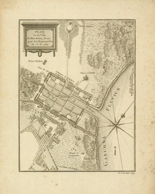
1) Plan de la Ville de Bordeaux, Batie par les Romains…, (5.6 x 7.3"), circa 1750. This fine copper engraved plan shows the town and vicinity as it appeared in Roman times. The small town is protected by a surrounding wall and trenching. Public baths are located west of town, the Roman amphitheater (Palais Galien) is located, as is the Temple de Vernemetis. The plan shows roads and orderly fields to the south. A compass rose and fleur-de-lis with rhumb lines orient the map with north to the upper right. On thick hand laid paper with wide margins and text-based watermark. Some light scattered foxing mostly at right margins, map image is very good.
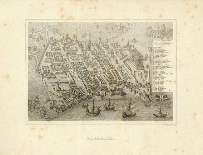
2) Bordeaux, (6.5 x 4.5"), circa 1840. Beautifully rendered and finely engraved bird's-eye view of the fortified town viewed from above the river. With fine detail and a key to locate all important buildings, hotels, convents, churches, the Chateau Trompete, etc. The protective walls and towers are well shown. Several traditional sailing boats rest in the river in the foreground. The Palais Galien is prominently shown in the background. Very wide margins with light scattered foxing, with a few spots in the image.
References:
Condition: B+
See individual descriptions.