Subject: France
Period: 1592 (published)
Publication: Theatrum Orbis Terrarum
Color: Hand Color
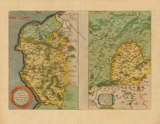
1) Caletensium et Bononiensium Ditionis Accurata Delineatio / Veromanduorum Eorumque Confinium Exactissima Descriptio (19 x 13.2"). Two maps on a folio sheet. Caletensium covers the coastline between Calais and Estaples in very good detail, based in part on a four-sheet map by Nicolas de Nicolay. Veromanduorum covers a small region surrounding Saint-Quentin in northern France. The map is oriented with south at top. The cartographical source of the map was Jean de Surhon who received royal privilege to make a map of the region in 1557. Each is covered with tiny forests and cities and has a decorative title cartouche. This map was replaced in 1598 with a map showing the Veromanduorum region with north at the top. Latin text on verso. Lovely old color and wide original margin with just a hint of toning.
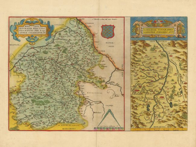
2) Regionis Biturigum Exactiss: Descriptio per D. Ioannem Calamaeum / Limaniae Topographia Gabriele Symeoneo Auct (19.2 12.2"). Two fine maps on a full folio sheet. The map of Biturigum is centered on Bourges, with the Loire River flowing at the top right of the map to Nevers. The cartography was based primarily on Jolivet's map of 1545. The map of Limaniae is focused on the Allier River valley . This map was based on the work of Gabriel Symeoni. Each map is richly embellished with forests, cities, mountains and elaborate title cartouches. Latin text on verso. Lovely old color with an old repair on the lower centerfold. Wide original margins with two short tears repaired with framers tape on verso.
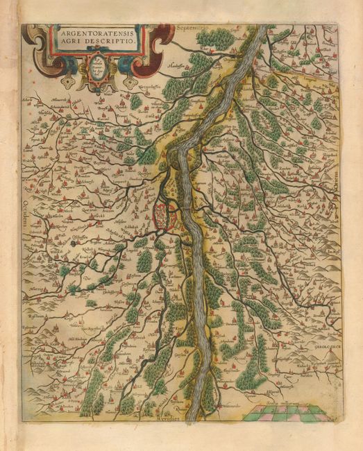
3) Argentoratensis Agri Descriptio (9.6 x 11/8"). This is a very detailed map of the vicinity of Strasbourg based on Daniel Specklin's 1576 map of Elsas. This map was separated from the folio sheet on which it was published with a map of Bavaria. Good impression and old color. Remargined at left to accommodate framing. There are a couple edge tears in the blank margins, not affecting the map.
References: Van den Broecke #44, 39 and 112b.
Condition: A
See descriptions.