Subject: England
Period: 1850 (circa)
Publication: Barclays Complete and Universal English Dictionary
Color: Hand Color
Thomas Moule (1784 – 1851) was a writer, bookseller, publisher, topographer and a scholar in heraldry. His varied career led him in 1830 to produce a series of English county map based on his own travel. He wrote that he has “with expensive diligence personally visited every county in England, excepting only Devonshire and Cornwall.” His maps were delicately engraved on steel in a highly decorative style, featured such embellishments as armorial bearings, figures, fancy borders and vignettes of local interest. This amount of ornamentation in mapmaking was unusual for the period as most mapmaker’s were instead creating scientifically accurate, austere works. His series of county maps were originally published in separate sections for each county (1830-32), then subsequently published in a two-volume work: The English Counties Delineated…, (1836). Beginning in 1841, the maps appeared in Barclays Complete and Universal English Dictionary.
Attractive lot of steel engraved maps providing detailed information of their respective counties, cities, towns, roads, canals and parks.
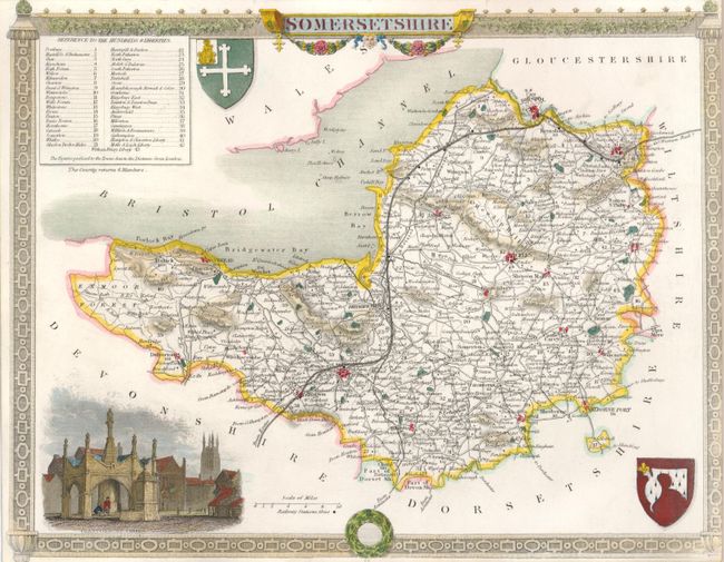
Somersetshire, circa 1850, (10.5 x 8.4"). With decorative border surrounding vignette of Glastonbury Cross and coats of arms. Close trimmed to edge of border at right, as issued, otherwise fine. (A)
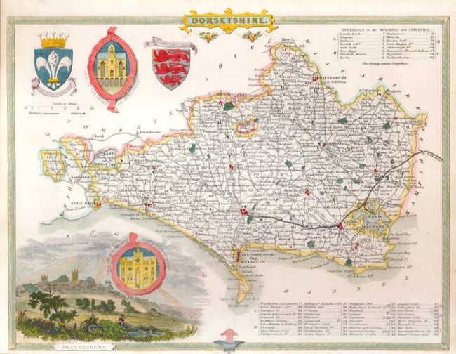
Dorsetshire, circa 1850, (10.3 x 8"). Includes vignette of Shaftesbury, Seal of the Abbey of Abbotsbury, Seal of Edward's Abbey Shaftesbury and handsome coats of arms. (A+)
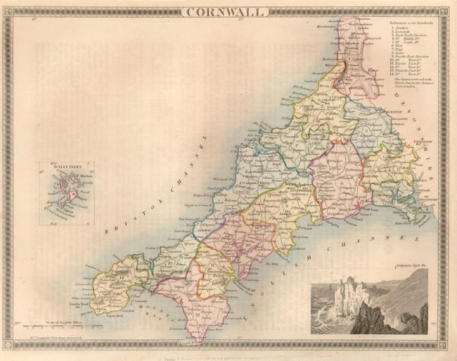
Cornwall, (10.2 x 7.8"). With inset of the Scilly Isles and a vignette of Land's End. (A)
References:
Condition:
See individual descriptions.