Subject: England
Period: 1675-98 (published)
Publication: Britannia
Color: Hand Color
Size:
17.5 x 13.3 inches
44.5 x 33.8 cm
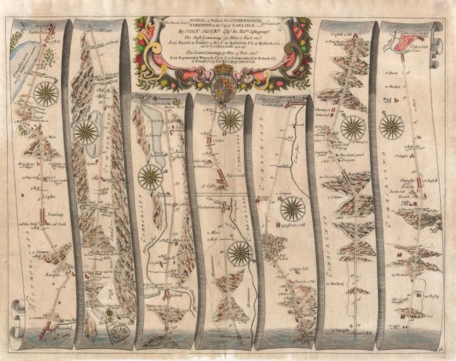
John Ogilby's 'Britannia' was published between 1675 and 1698. It is a landmark in the mapping of England and Wales. Its unique format constituted the first national road-atlas of any country in Western Europe. It was composed of maps of seventy-three major roads and cross-roads, presented in a continuous strip-form, on a uniform scale of one inch to a mile. Each beautiful map includes wonderful detail of the countryside with each strip containing a large compass rose to indicate changes in direction.
This road winds through the mountainous terrain beginning at Kendal through the towns of Stanlay, Ambleside, Cockermouth, Egremont and ending at Carlisle for a total distance of 82 miles, 43 to Cockermouth and an additional 39 miles to Carlisle. This map is more detailed than the majority from Ogilby's series and uses seven panels rather than the normal six. Each panel has a decorative compass rose to orient the traveler. Title cartouche in a strapwork and garland style featuring the bounty of the countryside, with the royal coat of arms at center.
References:
Condition: A
Very nice impression and color. Close margins as issued. Two professional repairs to centerfold in blank upper and lower margin.