Catalog Archive
Auction 135, Lot 400

"[Lot of 2] Land-Kaart van het Eiland en de Volkplanting van Cayenne aan de Kust van Zuid-Amerika [and] Land-Kaart van de Volkplantingen Suriname en Berbice", Tirion, Isaac

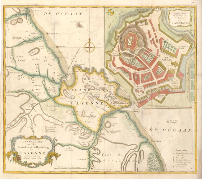
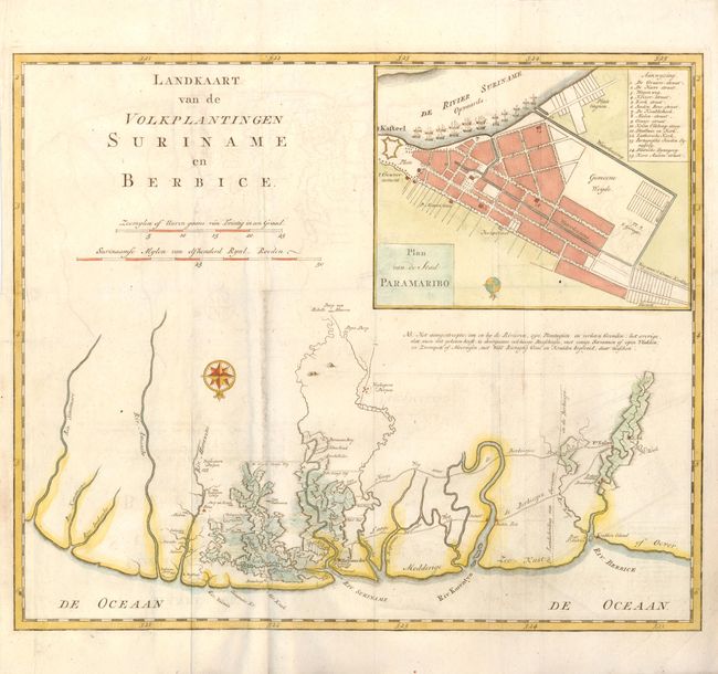
Subject: Guyana, Suriname, French Guiana

Period: 1769 (circa)

Publication:

Color: Hand Color

Size:
See Description
Download High Resolution Image
(or just click on image to launch the Zoom viewer)

Land-Kaart van het Eiland en de Volkplanting van Cayenne aan de Kust van Zuid-Amerika (16.4 x 14"). An attractive and detailed map of Cayenne in French Guiana. The large inset at upper right is a terrific example of a fortified castle. The map locates towns, villages, churches and more. Embellished with a rococo-style cartouche and a pair of compass roses.

Land-Kaart van de Volkplantingen Suriname en Berbice (15.8 x 13.2"). Handsome and very detailed map of the Dutch colonies of Suriname and Berbice. The plans show the rich plantations, roads and villages. Inset at top is a large plan of Paramaribo, the capital of Suriname. The chart is oriented with north at bottom by two compass roses.

References:

Condition: B+

Issued folded, now flattened with slight offsetting and surface soil.

Estimate: $200 - $275

Sold for: $120

Closed on 2/16/2011

Archived