Subject: Havana, Cuba
Period: 1762-82 (dated)
Publication:
Color: Black & White
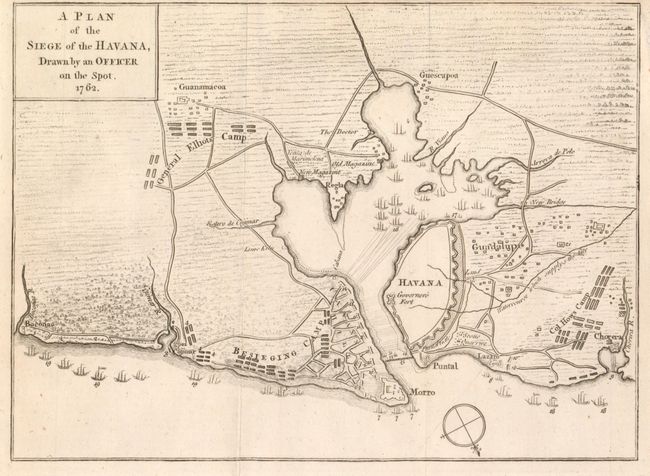
1) This highly detailed battle map was published in the October 1762 edition of the Gentleman's Magazine, 9.8" x 6.5". The plan of the harbor and region around Havana show the location of warships and other important details during the successful attack of British forces on Havana. This 1762 siege was the final battle in the Americas at the end of the French and Indian War. Locates the fortified city of Havana, Puntal, Guadalupe, Lazaro, Corera, Guescapoa, Guanamacoa, Boconoa, and Cojimar. A large number of British warships float offshore and another 18 are in the harbor south of Havana. Also locates the camps of Col. How and General Elliot, and a large Besieging Camp is on Cavanna's Hill behind the fortified town of Morro. Jolly GENT-163. Close margin at upper right, as issued. (A)
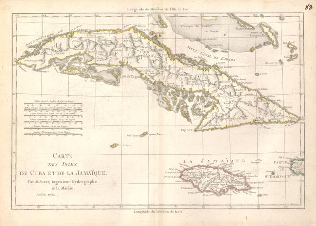
2) Carte des Isles de Cuba et de la Jamaique, Rigobert Bonne, Paris, 1782, 12.5" x 8.4". Nicely engraved copperplate chart of Cuba and Jamaica. Interior and coastal information is well presented. Six distance scales. Very nice example with just a little light soiling or toning, mostly in margins. (B+)
References:
Condition:
See individual descriptions.