Subject: United States & Mexico
Period: 1842 (dated)
Publication:
Color: Black & White
Size:
9.8 x 7.7 inches
24.9 x 19.6 cm
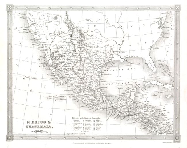
The first is a crisply engraved map that features the Independent Republic of Texas with S. Antonio de Bexar indicated as the capital and locates Victoria, Nacogdoches, Harrisburg, Guardia Barca and several more settlements. Mexico controls the entire southwest and California as Upper or New California. The Baja is Lower or Old California. The Great Salt Lake is Youta or Great Salt L. The Great Basin shows pre-Fremont information with several detached rivers and the Bonaventura River flowing across its breadth. New Albion is in the vicinity of Cape Mendocino. Detail including watershed, Indian Tribes, with scores of towns and villages located, some along the Rio Grande River but primarily throughout Mexico. The map extends to include Florida and most of the East coast, but all interior detail stops at the Mississippi except to name New York, Philadelphia, Washington and New Orleans. Table at bottom keys to 25 States of Guatemala.
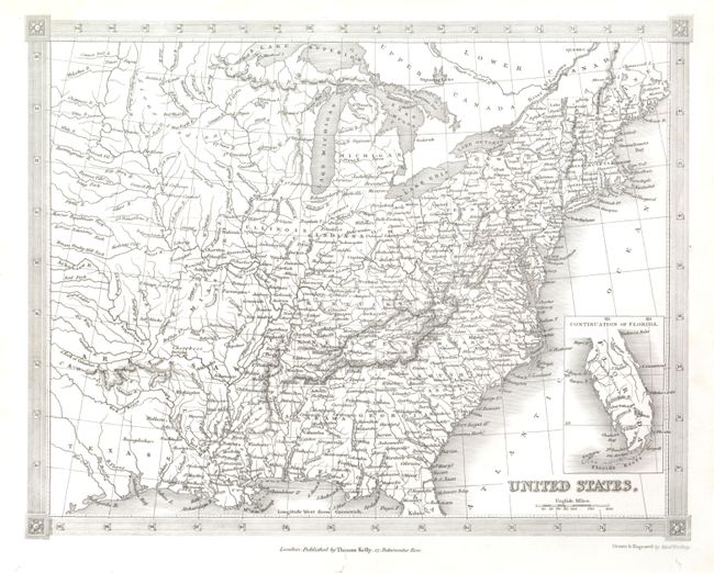
The second map "United States" extends to the west to include most of Texas. An inset "Continuation of Florida" is drawn on the same scale. Both maps surrounded with a fancy lined border with graphic elements at each corner and both with Kelly's imprint "17 Paternoster Row."
References:
Condition: A+
Both are flawless examples.