Subject: Indiana
Period: 1874 (dated)
Publication:
Color: Hand Color
Size:
16 x 26.2 inches
40.6 x 66.5 cm
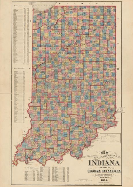
This double-page map is beautifully executed and engraved by D.L. Bourquin and published by the uncommon Chicago publisher, Higgins Belden & Co. It was likely published in an Indiana state or county atlas, which was the company's specialty. The map has remarkable detail throughout including small villages, post offices and all townships. Tables at left give the comparative population by county based on the 1860 and 1870 census. Another table gives the latest population figures for cities and towns. The Chicago map publishing industry in the nineteenth century is a fascinating study with many of the major players forming various partnerships and associations. Higgins is more often associated with Warner or Warner & Beers. Belden was a Canadian publisher out of Toronto. The association of Higgins and Belden is rarely seen, but they are known to have occupied space in the famous Lakeside Building, completed in 1873, which located several firms involved in all aspects of mapmaking under one roof.
References:
Condition: B+
Marginal separations on the centerfold and a tear in the table of cities at left are closed on verso with archival tape.