Subject: Chicago, Illinois
Period: 1910-1949 (circa)
Publication:
Color: Printed Color
This is a lot of seven maps of Chicago, most being pocket maps and all folding. Includes:
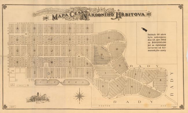
1) Mapa CeskoNarodniho Hrbitova, by Frank Pavlicek Co., circa 1910, black & white, (28.3 x 16.3"). This rare Czech-language map was made close to the turn of the century, a time when Chicago was the third-largest Czech city in the world, after Prague and Vienna. It shows the proposed 122 acre Bohemian National Cemetery. The cemetery is bounded by Pulaski Road on the West, Foster Avenue on the South, Bryn Mawr Avenue on the North and Central Park Avenue - Northeastern Illinois University - on the East. All street names are in Czech except for Foster and Crawford avenues. With a finely rendered vignette of "Brana," or Golden Gate. At lower left is the imprint for the "Frank Pavlicek Co." Across the top the map is embellished with Victorian-style flourishes and a floral theme with fancy block lettering. Date taken from the Newberry Library description. Folding as issued with a short split along on fold and a few light, diffuse stains at lower right. Some light pencil marks on map. (B+)
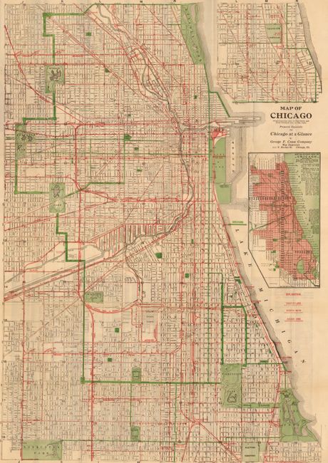
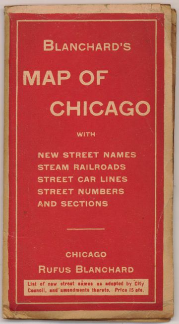
2)Map of Chicago, by Rufus Blanchard and George F. Cram Co., (23.8 x 36"). Very handsome map with red overprinting and style to delineate Street Railway Lines, Elevated Roads, and Railroad Lines. By the "George F. Cram Company Map Engravers 111 N. Market St. Chicago, Ill.". Blank verso. The map folds into paper covers "Blanchard's Map of Chicago…Rufus Blanchard." Very nice. (A)
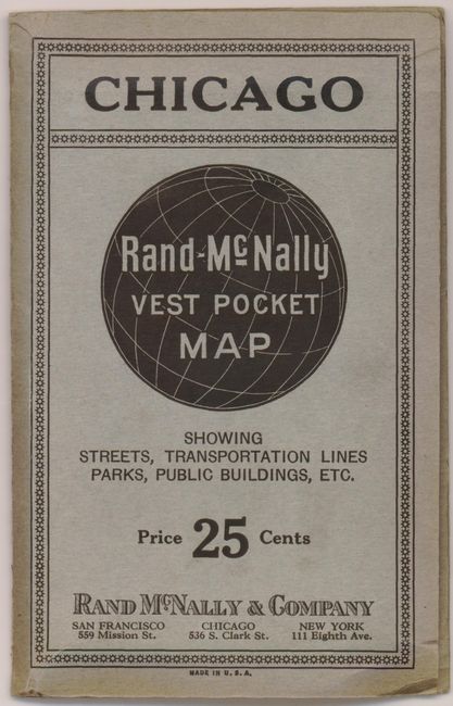
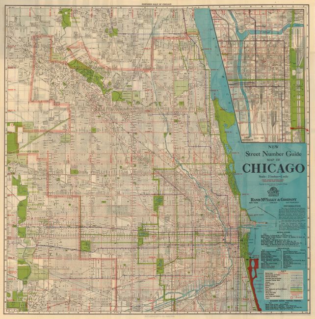
3)New Street Number Guide of Chicago, by Rand McNally & Company, circa 1937, (28.7 x 28.8"). Very nice city plan folds into covers "Chicago Rand-McNally Vest Pocket Map Showing Streets, Transportation Lines, Parks, Public Buildings, etc." (A+)
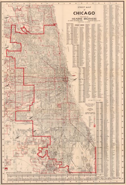
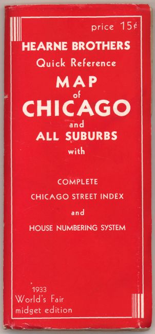
4)Street Map of Chicago, by Hearne Brothers, 1933, (21.3 x 31.6"). This large and beautifully printed map folds into red paper covers "Hearne Brothers Quick Reference Map of Chicago…1933 World's Fair midget edition." Map and covers are fine except for a small tear at side of rear cover. (A)
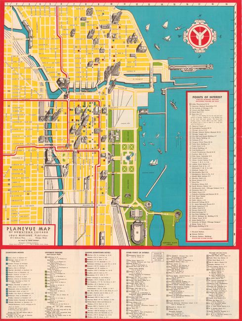
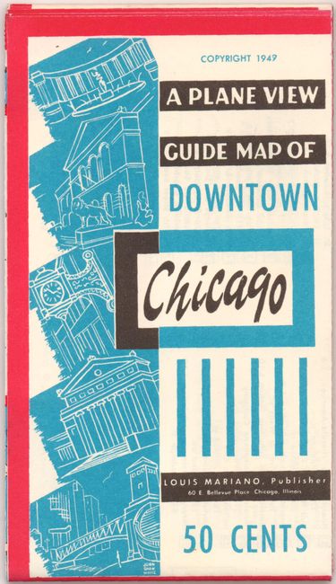
5)Planevue of Downtown Chicago, by Louis Mariano, 1949, (18 x 18.4"). Very colorful map in block colors with brightly overprinted red to delineate the Elevated Railroad. Drawn by Anne Donley. Self folds into covers "A Plane View of Guide Map of Downtown Chicago…50 cents." Slips in original pocket sleeve "Where to Go Where to Eat What to Do In Chicago." In the sleeve is a folding "Chicago Street Guide and Information Sheet," a color postcard "The Tribune Tower by Night, Chicago" and two shirt tags "Guest of the Merchandise Mart Guided Tour", never used with the name and date spaces blank. A remarkable time capsule from 1949. (A+)
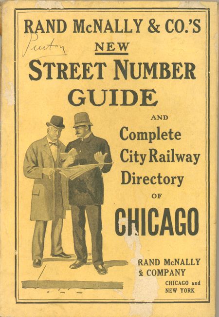
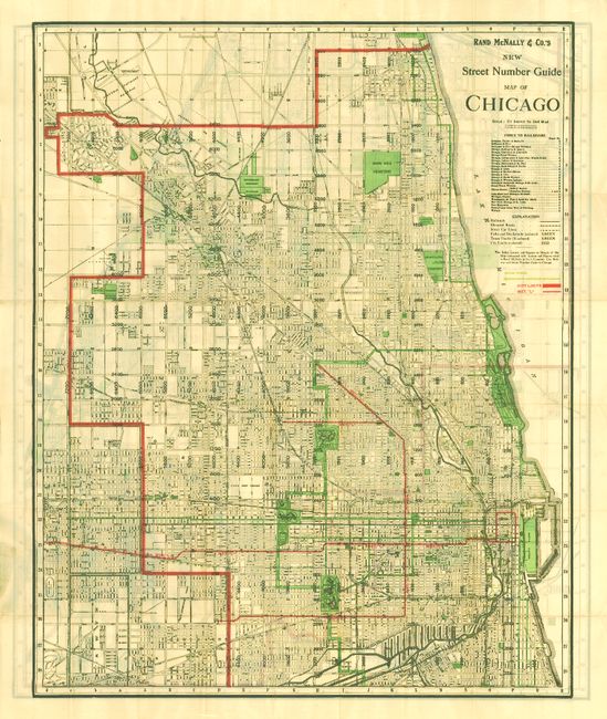
6) Rand McNally & Co.'s New Street Number Guide Map of Chicago, 1911, (27 x 33.5"). Thick pocket map with 219 pp booklet to streets with other information and numerous advertisements on un-numbered pages. Back cover split from book. Map is very nice. (B+)
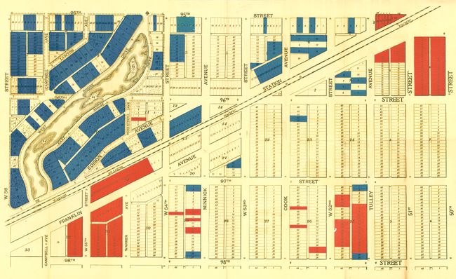
7) [Untitled - Section map of Oak Lawn], n.d. but circa 1910, (26.7 x 16"). Bounded by 50th on the east and 56th on the west, the plan extends between 98th and 95th. The Wabash St. Louis Pacific Railroad bisects the map diagonally. This is obviously one section of a larger map, but was never joined and has original blank margins. Folding as issued with a few short fold splits and some toning. (B)
References:
Condition:
See individual descriptions.