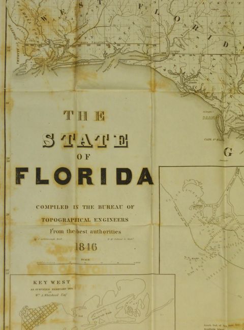
Subject: Florida
Period: 1846 (dated)
Publication: Topographical Engineers
Color: Black & White
Size:
39 x 41.5 inches
99.1 x 105.4 cm
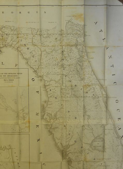
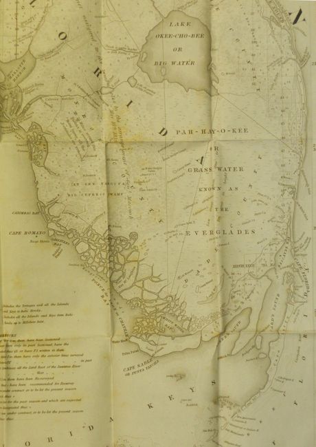
A very large and comprehensive map of Florida describing the status of Public Land Surveys. There is a remarkable amount of detail, showing rivers, lakes, coastal islands, towns, army posts, trails, etc. The southwest tip shows extensive fragmentation along the coast between Cape Sable and Cape Romano. Three inset maps: "Key West as surveyed February 1829"; "Mouths of Swanee R. and Cedar Keys showing the Western terminus of a proposed railroad"; and "A General Map of part of Florida included between Cedar Keys and St. John's River." Drawn by J. Goldsborough Bruff and finely engraved by D. McClelland of the Topographical Engineers. An early and very desirable Florida issue.
References:
Condition: B
This huge map is remarkable as it has no fold or intersection splits, in fact the paper is surprisingly sound. There is foxing and offsetting, particularly along the left side.