Subject: Colorado
Period: 1887 (dated)
Publication: Atlas of the United States
Color: Hand Color
Size:
20.2 x 15 inches
51.3 x 38.1 cm
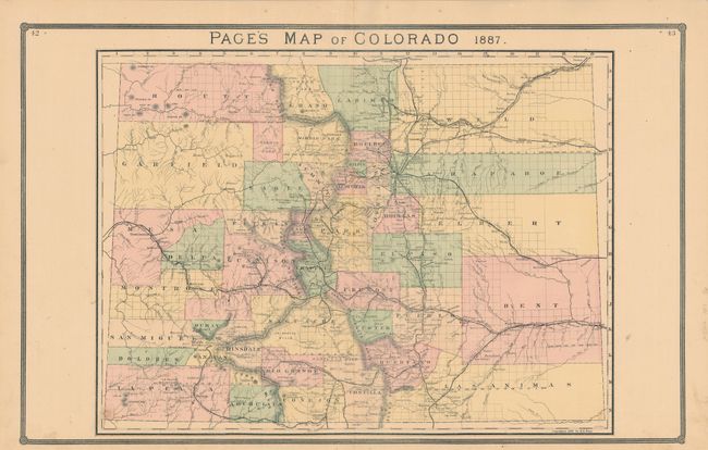
This is a rarely encountered and large map of the state showing early county development including the immense counties of Arapahoe, Elbert, Bent, Weld and Las Animas in the eastern plains. Several railroads are shown including a branch of the Denver & Rio Grande, which extends from Silverton to the mining town of Howardsville (a line that was proposed but never actually built). Locates many towns and mines and provides an excellent view of the topography. Telluride is located but no roads are shown in the area. Some uncommon place names appear including Tennessee Colony near Ft. Morgan. On verso is an index to Colorado plus an interesting information on "Government Lands" concerning homestead laws and prices and a list of towns, streams and populations of cities in 1880. Published by H.H. Lloyd in the Atlas of the United States.
References:
Condition: A
Just a few tiny spots in blank areas and a very short edge tear at bottom, else fine.