Subject: Colorado
Period: 1884-1889 (published)
Publication:
Color: Hand Color
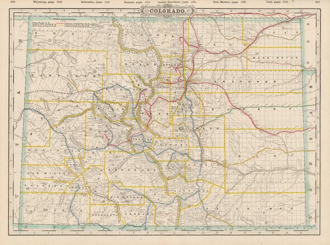
1) Cram, George F. & Company, Chicago, 1889, 22 x 16", Standard American Atlas. Great map of the state from this scarce railroad atlas which features both hand and printed color, a common practice during this transitional period to fully printed color. The numerous railroads are delineated and named with red overprinting that shows updates from the 1887 edition. Details counties, cities and towns, post offices, and mountains. The watershed is particularly well developed with scores of creeks and rivers named. Also locates military reservations, Indian reservations, and many geographical features important to travel such as buttes, hills, and peaks. Probably the most desirable Cram issue in flawless condition. (A+)
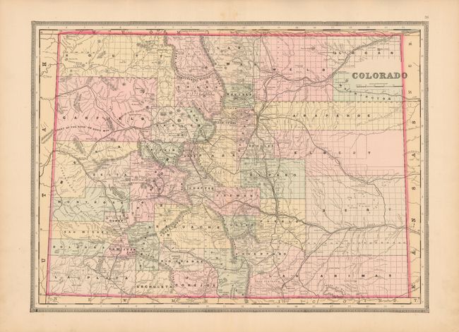
2) S.A. Mitchell, William M. Bradley [& Bros.], Philadelphia, 1884, 22.5 x 16.5", New General Atlas. This map continues the publication of Mitchell inspired maps. With large counties in the eastern plains which will fragment into numerous smaller counties in 1889. Fully hand colored this map presents the same county and railroad information as the Cram map above, but in an older style that is easier on the eye. Topography shown via hachure. Grand County has not yet yielded its upper half to Larimer which occurred in 1886. Decorative architectural borders. A near fine example with crisp impression, nice original color and full margins. (A)
References:
Condition:
See individual descriptions.