Subject: California, Nevada
Period: 1910 (dated)
Publication:
Color: Printed Color
Size:
26 x 33 inches
66 x 83.8 cm
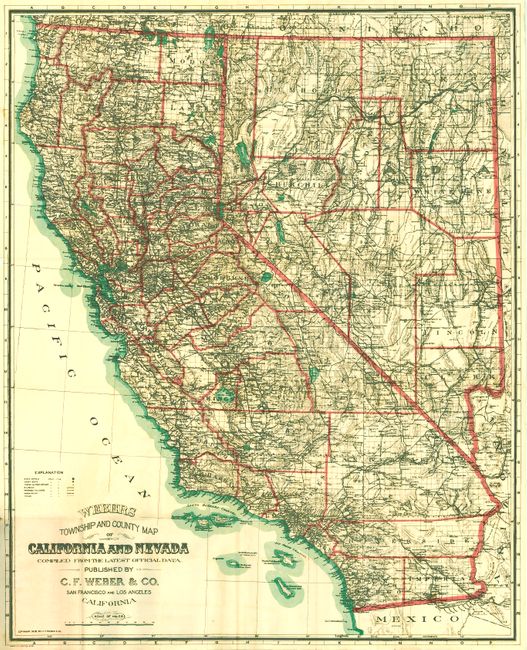
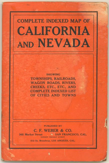
This large pocket map folds into orange paper wrappers titled "Complete Indexed Map of California and Nevada Showing Townships, Railroads, Wagon Roads, Rivers, Creeks, Etc., Etc., and Complete Indexed List of Cities and Towns." The map is absolutely filled with information including operating and proposed railroads, wagon roads and trails, towns and smaller settlements, townships, counties, lakes and reservoirs, springs, the rivers and creeks, and topography shown via hachure. Includes the islands off the Southern California coast including Santa Catalina. Handsomely colored in black, orange and green. Fancy lettering in the title. Complete with the 29pp extensive "Index to the Map of California and Nevada."
References:
Condition: A+
Map is exceptional with bright color and crisp impression and no flaws. The covers are very good except for some light water staining and a small (3/8") flaw at right edge. First page of booklet has some light scattered foxing, the rest is fine.