Subject: Alaska
Period: 1867-69 (dated)
Publication:
Color:
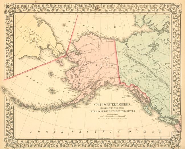
North Western America Showing the Territory Ceded by Russia to the United States, from S.A. Mitchell's New General Atlas, 1867, original hand color (14.5 x 11.5"). This very early map of Alaska is dated the same year the territory was purchased from Russia, in what was then known as Seward's Folly. It shows Alaska with no organized boroughs and a virtually blank interior, save for the occasional river and Fort Yukon. Just a few villages are named and there is no sign of Mt. McKinley. Sitka is called New Archangel. Close trimmed in lower margin, as issued. (A)
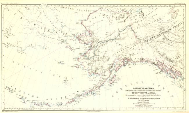
Nordwest-Amerika mit dem von Russland an die Verein Staaten Cedirten Territorium Alaska, by A. Petermann, from Petermann's Geographische Mittheilungen, 1869, hand color, (15.8 x 9.7"). Extends beyond Alaska to include much of Siberia and the Yukon Territory of Canada. Finely engraved with excellent detail of topography and watershed. Includes all of the Aleutian chain.
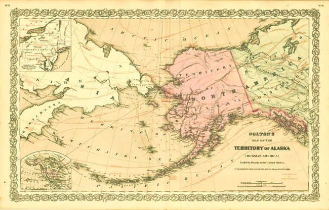
Colton's Map of the Territory of Alaska (Russian America) Ceded by Russia to the United States, by G.W. & C.B. Colton, 1867, hand color, (25.5 x 16"). This large map was published to commemorate the purchase of Alaska from Russia, then known as Seward's Folly. It is an uncommon thematic issue that features "Isothermal Lines by Lorin Blodgett," overprinted in red. The map shows the northern portion of Canada and a large amount of Siberia. With the inset "Diagram of the Middle States on the same scale as the main Map," also with Blodgett's isothermal lines. A second, small inset at lower left shows North America colored by country. It is a handsome map with full green color to the seas and other full colors in the interior.
References:
Condition:
See individual descriptions.