Subject: Western United States
Period: 1875 (published)
Publication: H.H. Lloyd & Co.'s Atlas of the United States
Color: Hand Color
This lot contains four maps by the famous Warner & Beers firm, primarily know for their state and county atlases.
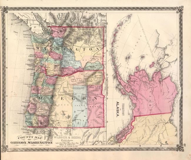
1) County Map of Oregon, Washington [with] Territory of Alaska, (16.8 x 13.5). Two maps within one border. The WA/OR map has early border development, the map of Alaska is too early for any political subdivisions.
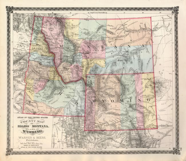
2) County Map of Idaho Montana and Wyoming, (16.3 x 13.8"). With interesting border configurations. Wyoming shows only five counties, the southern portion of Idaho is sparsely settled with only five counties while the eastern half of Montana is divided into five large counties. Great detail of watershed and with topography in hachure. The Union Pacific Railroad is well shown across the southern part of Wyoming but the entire region has no other railroads. In Idaho, Idaho Falls is Eagle Rock and Blackfoot is Corbetts Station. Numerous early mining communities are noted.
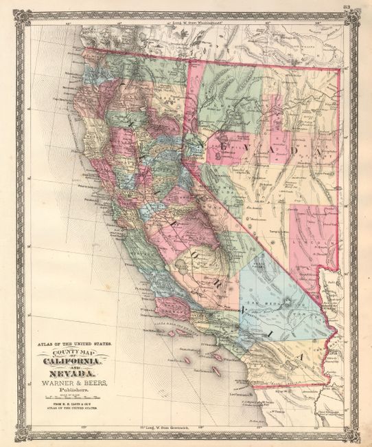
3) County Map of California and Nevada, (13.4 x 16.8"). Very nice map with much detail and fine coloring. Locates numerous railroads, cities and towns, watershed, forts, and more. Early county development in the south with a huge San Bernardino County extending nearly across the state. Railroads well developed with the lines in or planned to Ft. Yuma, Needles, and extending north to Redding. Death Valley is delineated and named. A handsome and uncommon map with decorative borders. A little marginal soiling or foxing.
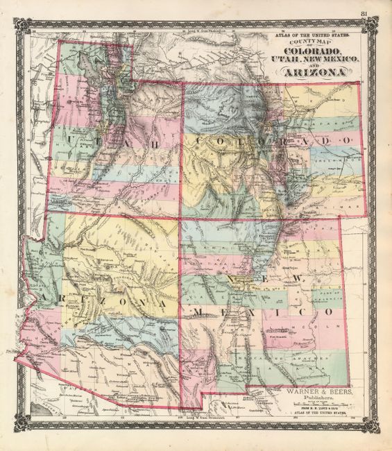
4) County Map of Colorado, Utah, New Mexico, and Arizona, (14 x 16"). Centered on the four corners the map features early county organization. Arizona has just five counties. It has early references to Phoenix and East Phoenix, an uncommon place name. There is good detail throughout including numerous railroads, cities and towns, watershed, forts, etc. There are some early references to mining near Tubac, Arizona and west of the Rockies in Colorado (Oro City). Railroads in an early stage of development, with lines in Colorado and the Transcontinental line delineated in northern Utah. A handsome map with decorative borders and graphic elements at each corner.
References:
Condition: A
All very good with dark impression and bright original hand coloring.