Subject: Western United States
Period: 1848 (dated)
Publication: HR Ex Doc. #17, 31st
Color: Black & White
Size:
16.5 x 19.5 inches
41.9 x 49.5 cm
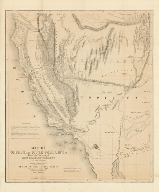
This is the smaller version of Fremont's highly respected map of the American West. It was published by Congress in 1850 to meet the demand for information concerning the California Gold Rush. The map covers a smaller area than his larger map of the same title, eliminating Oregon and covering California and only the western parts of present-day Arizona and Utah. The El Dorado or Gold Regions are shown on the south fork of the American River and the upper course of the Feather River. It contains Fremont's famous topographical error, showing an east-west mountain range across the unexplored area of the Great Basin.
References: Wheat (TMW) #613; Wagner Camp #150; Wheat (Gold) #58.
Condition: C+
This map presents very well with full margins, nice impression and clean appearance save a faint line of offsetting near lower margin. However, some of the folds are weak with a few splits between vertical folds. Puncture left of upper centerfold. With tissue backing this will be a fine example.