Subject: Colonial Central United States
Period: 1757 (dated)
Publication: l'Histoire Generale des Voyages
Color: Hand Color
Size:
11.8 x 8.6 inches
30 x 21.8 cm
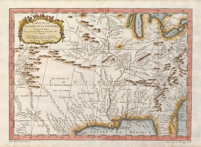
Finely engraved and detailed map of French Louisiana that extends from the Great Lakes and Michigan to the Gulf of Mexico, and from Nouveau Mexique to the middle of Florida. The Mississippi River flows dramatically down the center of the map with tributaries including the Ohio River, (l'Oyo ou la Belle), Missouri River, and the Riviere de Moingona in the area of modern-day Des Moines. Locates Santa Fe, Apache tribes and an early reference to Texas as Pars des Cenis. The map is filled with many Indian names, missions, forts and early settlements. Early explorations are noted including la Salle en 1685 in today's Texas. Adorned with a decorative rococo title cartouche which incorporates a distance scale.
References: Sellers & Van Ee #75.
Condition: A+
Beautiful example on thin hand laid paper with dark impression. Fine less a short tear in lower margin, invisibly and professionally closed on verso.