Catalog Archive
Auction 135, Lot 191

"Carte de la Louisiane, et de la Floride", Bonne, Rigobert

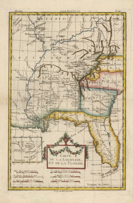
Subject: Colonial South

Period: 1770 (circa)

Publication: L'Histoire Philosophique et Politique…

Color: Hand Color

Size:
8.4 x 12.8 inches
21.3 x 32.5 cm
Download High Resolution Image
(or just click on image to launch the Zoom viewer)

This is the more decorative version of this interesting map of the American south and the Mississippi River valley. The map extends from Charleston, South Carolina west to include New Orleans and north into Illinois. The Mississippi and Ohio Rivers are finely described. Florida is shown with its panhandle extending west to include Mobile and Biloxi. A small inset provides details of the Missouri River. The title cartouche is topped bedecked with an urn and garlands.

References:

Condition: A

Marginal fold separations have been neatly repaired.

Estimate: $275 - $325

Sold for: $250

Closed on 2/16/2011

Archived