Subject: Colonial Southeast
Period: 1778 (published)
Publication:
Color: Hand Color
Size:
28.5 x 20 inches
72.4 x 50.8 cm
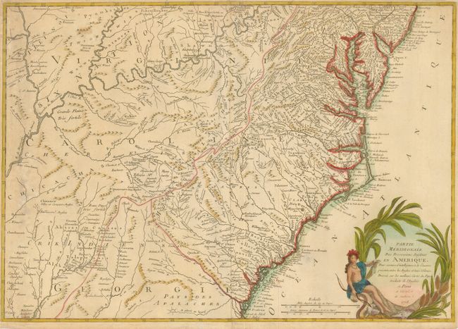
This is the rare, southern sheet of a two-part, French translation of John Mitchell's famous map of colonial North America. This sheet covers the southern theater of the Revolutionary War in the colonies from Shrewsbury NJ to Jekyll Island in Georgia and inland territory westward to the Mississippi River. The map stands on its own with a lovely title cartouche featuring a female representation of America. The map was separately published and only a few were produced.
Ambrose Verrier and Francoise Perrier were apprentice engravers who succeeded their employer, Roch-Joseph Julien in his Paris map shop located at the Hotel de Soubise in 1777. Since the loss of the French colonies in America in 1763, French cartographers relied on English maps for new information on North America. Verrier and Perrier established a relationship with William Faden, publisher of the Mitchell map. Their investment in these maps reflects the increased demand in France for maps of North America during the Revolution. It is one of the first cartographic efforts published following the alliance formed between France and the American Revolutionists in February 1778.
References: Sellers & Van Ee #161.
Condition: B+
The margins have been trimmed, but are still adequate for framing. There is some minor foxing in the map and a few old paper repairs in the margins on verso.