Subject: Colonial Southeast
Period: 1749 (dated)
Publication: Atlas Portatif Universel et Militaire
Color: Hand Color
Size:
6.8 x 6.4 inches
17.3 x 16.3 cm
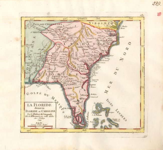
This rarely seen map depicts the Southeastern United States as far west as Mobile Bay and north to the border between Carolina and Virginia. The Florida peninsula is fragmented into several large islands. Florida has a large extension that completely cuts off Georgia leaving it as only a small sliver on the coast. Louisiana is to the west and Carolina occupies a large area north. Locates Pensacola, St. Augustine, Beaufort, Charlestown, and the forts George, Argile, First, Conde and more. There are many early settlements and forts named. Includes the northern portion of the Bahamas Islands. Page number 189 engraved above neatline.
References: Pedley #472.
Condition: A
A lovely example that is virtually fine with strong impression, full color and wide, original margins. Just one spot in left margin against border and a tiny hole in wide left margin closer to edge.