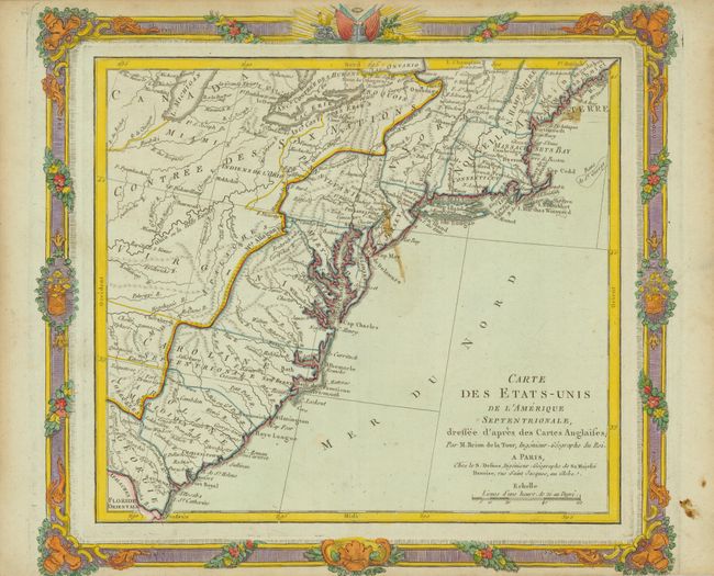
Subject: Eastern United States
Period: 1784 (circa)
Publication:
Color: Hand Color
Size:
12 x 10.7 inches
30.5 x 27.2 cm
The mapmaker quickly responded to the newly formed United States by coloring the borders of the newly formed thirteen states over an earlier plate with colonial boundaries engraved. The western boundaries of the southern states stop at the Allegany Mountains except for Georgia, which shows its boundary extending off the map. Beyond the United States is the Contree des Six Nations. Numerous place names, Indian regions, forts and rivers are located on this relatively early chart of the United States. The map is surrounded by a bold decorative border, topped with a small military theme. The border was printed from a separately engraved plate, leaving a second plate mark.
References: Sellers & Van Ee #740.
Condition: B+
Good impression with original color in the map and later coloring in the border. There is a stain near Cape May, else very good.