Subject: Western United States and Canada
Period: 1840 (published)
Publication:
Color: Black & White
Size:
5 x 7.8 inches
12.7 x 19.8 cm
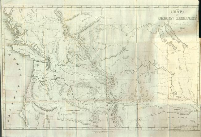
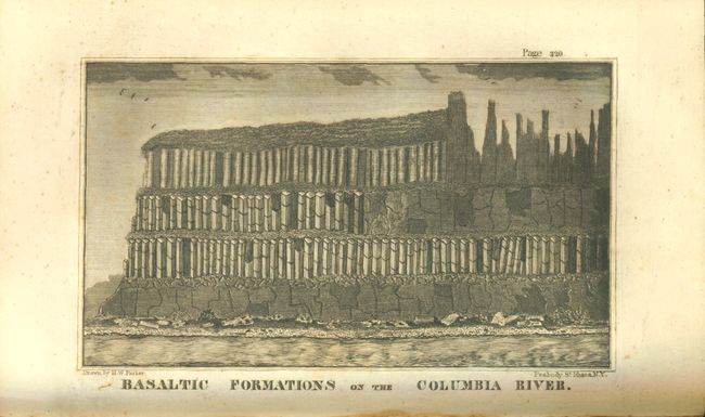
Samuel Parker was a missionary who accompanied a fur-trading party on an expedition from Council Bluffs, Iowa to the Oregon Territory. At the time, the region was claimed by both the British and the United States and was little known except to fur-traders. The folding map Map of Oregon Territory…, 1838(22.4 x 14"), and the wood engraving of the Basaltic Formations on the Columbia River are both present in this complete volume. Parker's map, based on both personal observation and reports of the fur-traders of the Hudson Bay Company, is considered a landmark in the mapping of the region. The map provides an excellent view of the river systems and tribal territory. It shows several forts, including an early depiction of Fort Hall. The map extends to include much of present-day Canada. The map is still bound in the original book in which Parker tells of his incredible experiences on the expedition. The books preface refers to the map as being "far more accurate than any which has before been published."
References: Howes P89.
Condition: B+
The map is very good (B+), with a few very light spots and a repaired binding tear in the border, otherwise clean and bright. Original binding with a little shelf wear and sunned on spine. Front blank end paper with owner's name. The contents are tight and with occasional light foxing spots, more at front, but some pages are very clean.