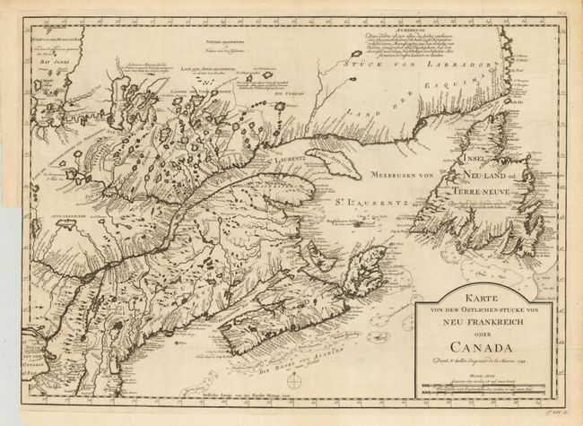
Subject: Colonial New England and Canada
Period: 1744 (dated)
Publication: Allegmeine Historie der Reisen zu Wasser und zu Lande
Color: Black & White
Size:
22 x 15.5 inches
55.9 x 39.4 cm
This is the German edition of Bellin's map , under appreciated map of the colonies published by Tirion. It was originally published for Charlevoix' Journal Historique d'un Voyage fait par Ordre du Roi dans l'Amerique Septentrionale. The map covers the eastern seaboard from Boston (Baston) through Newfoundland to the coast of Labrador. It provides excellent detail of the mouth of the St. Lawrence, the length of the river, the Maritime provinces and particularly the French claims in the region. It is a fine example of Bellin's engraving style and the extent of French exploration in the region. Bellin's definitive map of Eastern Canada and Newfoundland was copied by numerous cartographers in the 18th century. Plate and page number in the top and bottom margin.
References: cf Kershaw #686; McCorkle #744.3.
Condition: A
Beautiful, dark impression that is quite striking. On a full sheet with a large fleur-de-lis watermark. The lower left edge is trimmed right to the neatline, as issued for folding and binding.