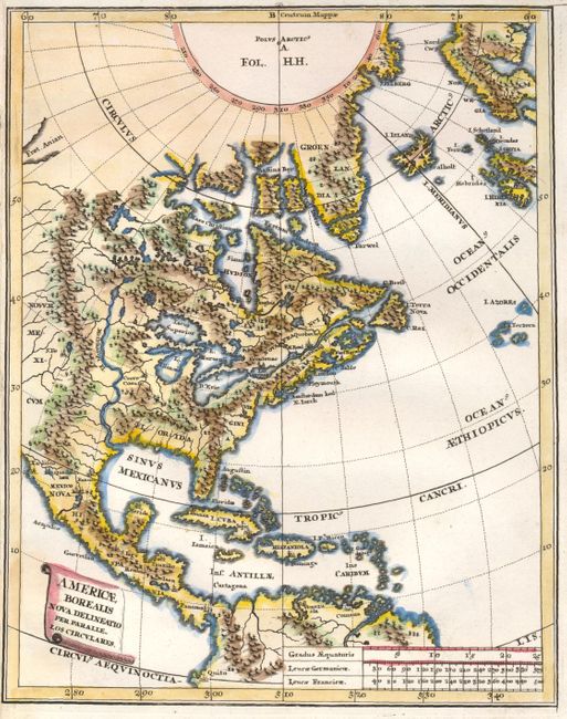
Subject: North America
Period: 1710 (circa)
Publication: Atlas Novus
Color: Hand Color
Size:
7.3 x 9.2 inches
18.5 x 23.4 cm
This attractive small map covers most of North America extending eastward from the Rocky Mountains and includes Central America with the West Indies. It also reaches to the North Pole, Greenland, Iceland and part of Scandinavia. The Great Lakes are over-sized, and the Mississippi River (Meschasipi Fl.) is misplaced too far west; flowing from a large lake in present-day Canada and emptying into the Gulf of Mexico in present-day Texas. The Fret. Anian is shown at the upper left, alluding to a possible Northwest Passage. There are only a few place names, including New York, Plymouth, St. Augustine, Santa Fe, Havana, Mexico, and Acapulco.
References:
Condition: B+
Map image and impression are fine (A+), but close left margin lowered ranking to B+. Full hand coloring.