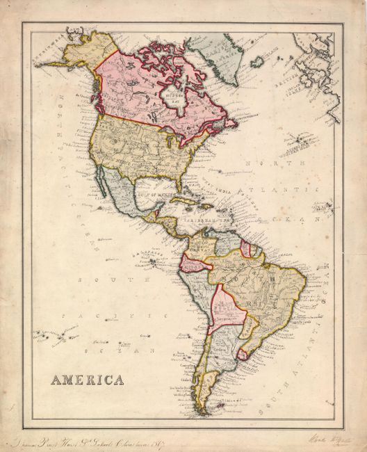
Subject: Western Hemisphere
Period: 1867 (dated)
Publication:
Color: Hand Color
Size:
14 x 17.7 inches
35.6 x 45 cm
This finely executed manuscript map of the Americas depicts the political divisions and rivers of each country. Well drawn and beautifully hand colored. There are also many more place names than on most school manuscript maps. The map is drawn in ink, hand colored, and signed in the bottom margin Thomas Priest Hurst, St. Schools Christmas 1867. Preparation of manuscript maps was a typical early 19th century classroom exercise. These classroom maps are found in several public map collections. But they are quite rare due to their ephemeral nature.
References:
Condition: B
Some scattered foxing and marginal tears, one of which enters the border at right, closed on verso with archival tape.