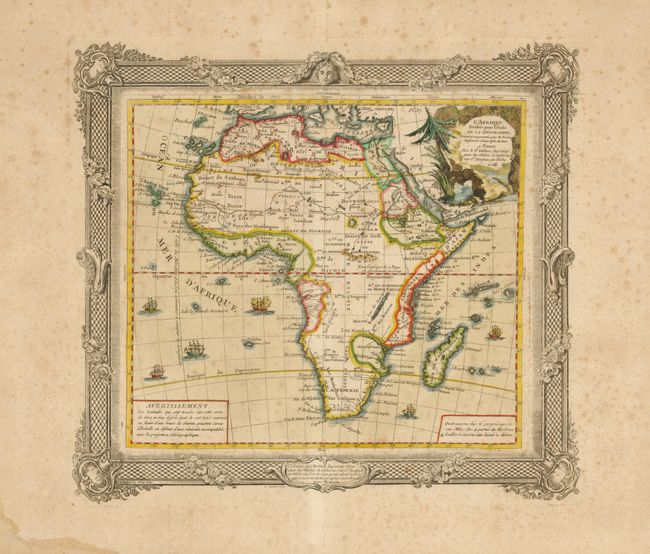
Subject: Africa
Period: 1766 (dated)
Publication: Atlas General
Color: Hand Color
Size:
13.3 x 12 inches
33.8 x 30.5 cm
Handsome continental map decorated with a pictorial title cartouche and several ships under full sail. The interior of the map contains little geographical information, as is typical of the period. Large rivers are evident but the larger lakes are not marked. The Nile flows from two small lakes, located in the Mts. de la Lune above the equator. In the south there is a minimum of place names and a few tribal names. Brion was the former Geographer to the King of France, and Desnos was Geographer to the King of Denmark. This edition is exactly the same map as described by Norwich but has a slight variation on the highly decorative surrounding border. A separate plate was used to print the border.
References: Norwich #97.
Condition: B+
Very nice impression on a full sheet of thick hand laid paper with wide margins. Light scattered foxing evenly disbursed. In the lower left blank corner is an area of either thick sizing or varnish.