Subject: Africa
Period: 1763 (dated)
Publication: Nieuwe en Beknopte Land Atlas
Color: Hand Color
Size:
13.8 x 13.8 inches
35.1 x 35.1 cm
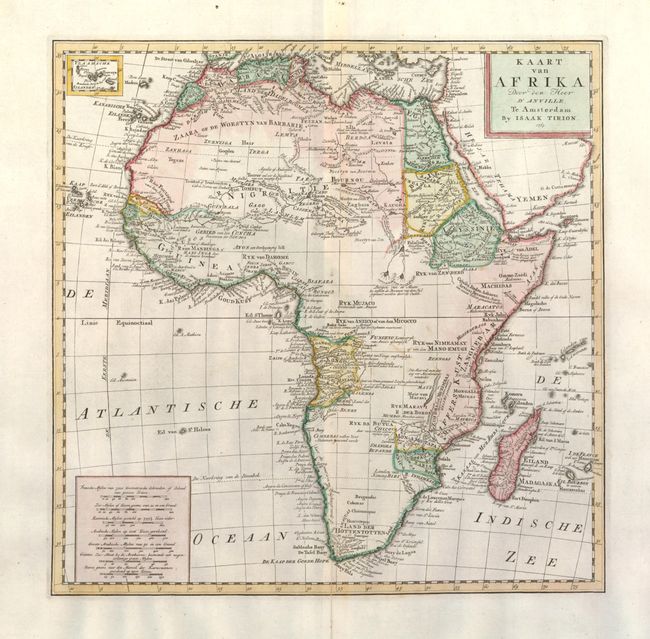
Attractive map of the continent with a small inset of Cape Verde Islands at top left. The map is based on D'Anville and includes a remarkable amount of detail including some gold and silver mines. Stellenbosch, Drakenstein and Waveren are located, as well as the rivers Berg, Olyphantin, Breede and Zonde End. Zimbabwe is labeled and a Groote Waterval (Great Waterfall) is shown in the vicinity of Victoria Falls. The source of the Nile is shown both according to Paez and in two small lakes north of the Equator.
References: Norwich #96.
Condition: A
Nice impression with wide original margins. A separation on the fold at bottom has been repaired and the centerfold is reinforced.