Catalog Archive
Auction 134, Lot 681

"Nouvelle Carte de l'Afrique avec des Remarques et des Tables pour Trouver sans Peine les Differents Peuples de cette Partie du Monde…", Chatelain, Henry Abraham
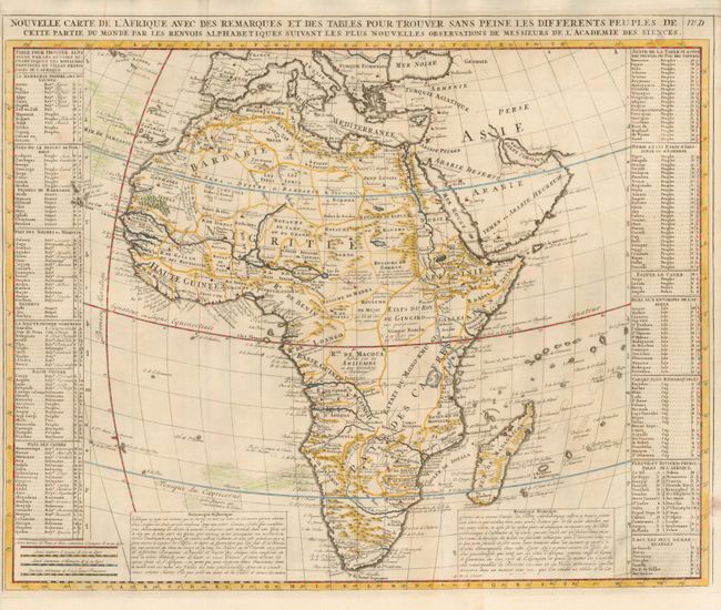
Subject: Africa

Period: 1718 (published)

Publication: Atlas Historique…

Color: Hand Color

Size:
23 x 18.2 inches
58.4 x 46.2 cm
Download High Resolution Image
(or just click on image to launch the Zoom viewer)

This map is based on Delisle's landmark map of Africa (1700), which was the first to present a non-Ptolemaic version of the source of the Nile and to correct several other rivers, and place the Mediterranean Sea on the correct longitude. Chatelain's map shows Lake Dambia, in Abyssinia, as the source of the Nile. The tables at either side list the major nations with a key to their geographic location on the map. The map was the cooperative work of Chatelain and Nicolas Gueudeville, a cartographer and printer.

References: Norwich #73.

Condition: A

Very handsome example with fine, dark impression.

Estimate: $400 - $500

Sold for: $350

Closed on 12/1/2010

Archived