Subject: East Indies - Borneo
Period: 1657 (circa)
Publication: Novus Atlas
Color: Hand Color
Size:
20.5 x 16.4 inches
52.1 x 41.7 cm
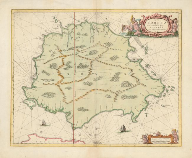
The mapping of Borneo suffered from the general lack of exploration through much of the otherwise robust period of discovery in South East Asia. Until this map appeared, the island was depicted with a few Portuguese place names along the western coastline, the large Brunei Bay, and a blank and generally flat eastern coastline. This map, oriented with north to the right, was a great improvement particularly on the east coast. This map appeared in Jan Jansson's sea-atlas, Waterwereld, which formed a section of Volume V of his Novus Atlas. It is one of the few early maps that focus on the island. It is adorned with two cartouche featuring merfolk and putti, compass roses and two sailing ships.
References: Suarez (SEA) p. 207, fig. 120.
Condition: A
Professional paper restoration in the blank margins with a tiny bit in the map border at top and bottom centerfold.