Subject: Southern Asia
Period: 1574-1730 (circa)
Publication:
Color:
Claudius Ptolemy was a mathematician, astronomer and geographer who worked in Alexandria, then a part of the Roman Empire, in the 2nd century AD. One of the most learned and influential men of his time, his theories dominated both astronomy and geography for nearly 1500 years. His writings were kept alive by Arabic scholars during the Middle Ages and reemerged in Europe during the Renaissance. The birth of printing led to wide dissemination of his great works on astronomy and geography. There were a number of editions of his Geographia beginning in 1477. These early editions contained maps based on his original writings, known as Ptolemaic maps. As geographic knowledge increased with the explorations of Columbus, Magellan, Cabot and others, maps of the New World were added, and maps of the Old World were revised. Ptolemy's Geographia continued to be revised and published by some of the most important cartographers including Martin Waldseemuller, Sebastian Munster, Giacomo Gastaldi, Jodocus Hondius, and Gerard Mercator (whose last edition was published in 1730).
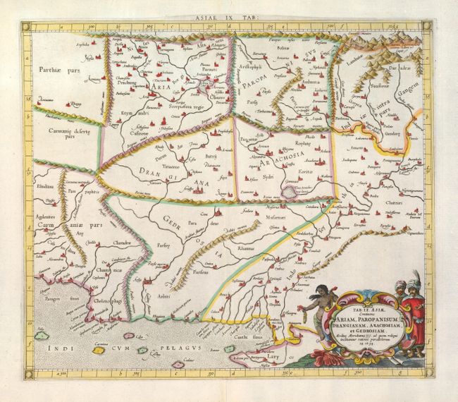
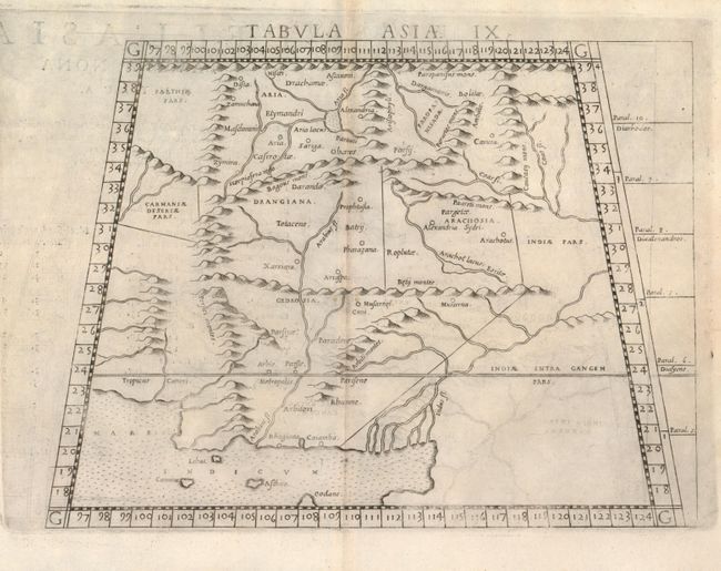
These two maps, from two editions of Ptolemy's great Geographia, span over 150 years. They describe the region to the west of the Indus River in what is present-day Pakistan, Afghanistan and part of Iran. Bold mountain ranges divide the historic regions, which include Parthia, Aria, Paropanisus, Carmania, Drangiana, Arachosia, Gedrosia and Indiae intra Gangem.
1) Tab: IX. Asiae, by Gerard Mercator, from Claudii Ptolemaei's Atlas Tabulae geographicae Orbis Terrarum, 1730, hand colored (15.8 x 13.7"). Mercator originally published this map in his 1578 edition of Ptolemy's great Geography; this version being from the last edition. Although he is most renowned today for the projection he popularized and for first using the term Atlas for a collection of maps, he devoted much of his life to his Ptolemaic maps. The maps were beautifully engraved as nearly as possible to their original form and embellished with fine cartouches. Condition: Centerfold separation in bottom blank margin expertly repaired. (A+)
2) Tabula Asiae IX, by Girolamo Ruscelli, from La Geografia di Claudio Tolomeo, circa 1574, black & white (9.3 x 7"). This is from an Italian edition and is presented on a trapezoidal projection. Condition: Faintly toned on centerfold with some light offsetting and minor show-through of text on verso. (B+)
References: Mickwitz & Miekkavaara (Nordenskiold) #235-15 & #220-24.
Condition:
See descriptions.