Subject: China, Korea & Japan
Period: 1774-1830 (published)
Publication:
Color:
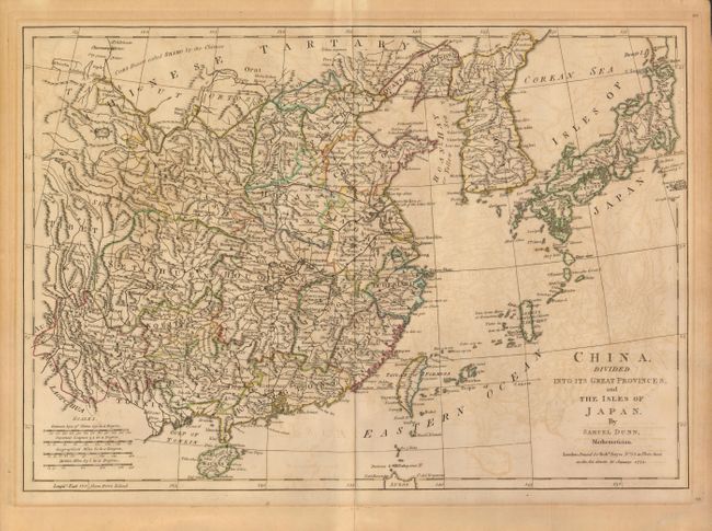
1) China, Divided into its Great Provinces, and the Isles of Japan, Samuel Dunn, 1774, hand colored, (17.4 x 12"). An uncommon map, published by Robert Sayer, focuses on the provinces and includes many place names and good detail of the numerous small islands and Okinawa which lay between Japan and Taiwan (Formosa). The sea between Korea and Japan is called the Corean Sea. In China there is excellent detail of political divisions, towns and villages, roads, mountains and rivers. Locates Pekin and boldly depicts the Great Wall. Both longitude scales are from Ferro Island. Overall offsetting and toned in margins from old framing. (B)
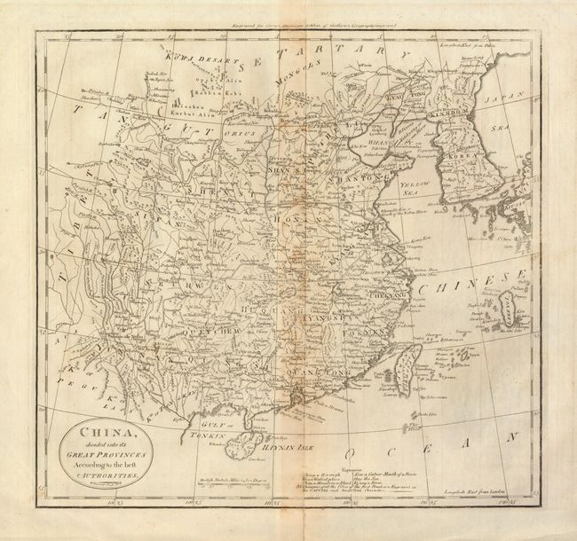
2) China, divided into it's Great Provinces According to the best Authorities., Mathew Carey, from American Edition of Guthrie's Geography Improved, black & white, circa 1830, (13.8 x 13"). A similar map as the former which also shows Formosa (Taiwan), Korea and parts of Japan including Okinawa. Full margins. The centerfold is toned and has a closed split into lower border. (B)
References:
Condition:
See individual descriptions.