Subject: Crete
Period: 1688 (circa)
Publication:
Color: Hand Color
Size:
21.2 x 18 inches
53.8 x 45.7 cm
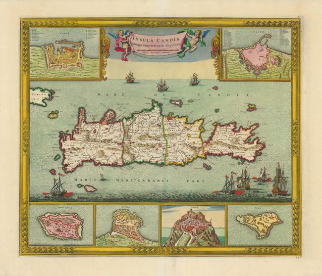
This dramatic map of Crete shows the island following the Seige of Candia, a 24-year long conflict in which Ottoman forces besieged the Venetian-ruled city and were ultimately victorious. The map is based on the cartography of Sebastien de Pontault de Beaulieu, who mapped many of the Mediterranean fortifications in about 1674. The island is filled with good information on roads, towns and topography. Six insets showing the fortifications of Canea, Candia, Spina Longa, Retimo, Thine, and Suda are minutely engraved with numbered keys identifying specific sites in Chania and Candia. The sea is filled with many war ships representing the epic struggle, and the banner-style title is held aloft by two putti.
References: Zacharakis #2392.
Condition: A+