Catalog Archive
Auction 134, Lot 577

"Carte Topographique des Pays et Cotes Maritimes qui Forment le Detroit de Gibraltar. Topographische Carte der Lander und Kusten Welche die Meer Enge von Gibraltar", Homann Heirs
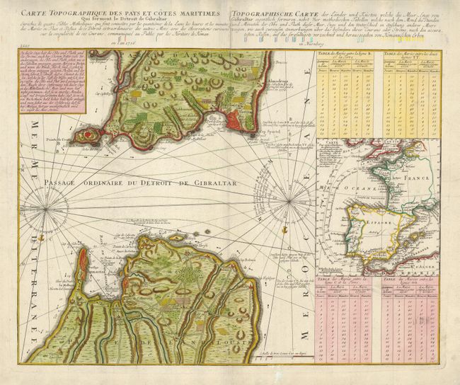
Subject: Gibraltar

Period: 1756 (dated)

Publication:

Color: Hand Color

Size:
22 x 16.5 inches
55.9 x 41.9 cm
Download High Resolution Image
(or just click on image to launch the Zoom viewer)

The strategic Strait of Gibraltar is the focus of this unusual chart that provides exacting detail of the fortifications on both the Spanish and African coasts. Four tidal tables compare tide levels and times at different seas with notes on the currents. A large inset map illustrates the major shipping routes between the British Isles and Marseilles, France.

References:

Condition: A

Backed with light Japanese tissue with professional repair of the centerfold.

Estimate: $700 - $900

Unsold

Closed on 12/1/2010

Archived